If a tree falls in the river…

If you’re keen to explore the upper passages of the Quinnipiac River by canoe or kayak, be prepared to duck, climb and carry. Downed trees and woody debris form frequent obstacles, requiring clever craft maneuvering or an occasional short portage. The Quinnipiac River Fund estimates that 30 – 40 newly fallen trees impact the river each year. That’s a significant nuisance for boat navigation, so why not remove them?

While they may be inconvenient, the most eco-sensitive solution is not to extract them, the Fund explains, but rather address the root of the problem, which happens to involve the roots. Trees along the Quinnipiac are uprooted more often than those along less-developed waterways due to the high-levels of impervious cover in Quinnipiac’s watershed. Hard surfaces — such as driveways, roads and parking lots — carry stormwater at greater amounts and velocities than natural surfaces, leading to increased bank erosion and more frequent tree falls.

To help mitigate the erosion, the Fund supports efforts aimed at educating landowners and municipalities on the importance of low-impact development, including encouraging towns to require vegetative buffers — strips of land with permanent vegetation designed to intercept rapid stormwater runoff.

In the meantime, the USDA Natural Resources Conservation Services and Connecticut Department of Environmental Protection suggest that most wood and downed trees should be allowed to remain in the river, as they help reduce the erosion problem by dissipating energy and stabilizing the banks. Likewise, DEP fisheries say that fallen trees provide important habitat for fish and wildlife.

Although removal of the downed trees is discouraged, minimal clearing and cutting is permissible, and often critical, to provide safe passage for water activities. Organizations like the Quinnipiac River Watershed Association organize clean-up activities and train volunteers to address the fallen trees in a manner sensitive to both environment and recreational access.

So when you encounter a maze of trunks and branches on your next Quinnipiac adventure, remember the river’s many challenges, and let the inconvenience propel you to action for a healthier Quinnipiac. Visit our conservation page to see how simple household actions — from lawn care to composting — can make a difference.


On Board for a summer of sea stewardship

Schooner Camp excites kids to care for the environment through songs, games and adventures.

“Imagine a clean river as it flows through a healthy watershed. In this river lives Fred the Fish. Fred has lived here his whole life, but today he is starting a long journey downstream to the ocean. HOW IS FRED?”

The Schooner Camp counselor introduces the kids to Fred, a sponge cut into the shape of a fish. Then, one by one, the children enact Fred’s journey by reading a card they were given and following its instructions.

Fred’s travels include:

  • Fred swims into farm country. He passes a freshly plowed riverbank. It begins to rain and some soil erodes into the river. (DUMP SOIL INTO FRED’S WATER) HOW IS FRED?
  • Fred swims under a bridge. The winter trucks put salt on the road. The rain washes the salt into the river. (ADD SALT TO FRED’S WATER). HOW IS FRED?
  • Fred swims past the city park. Some picnickers didn’t throw their trash into the garbage can. The wind is blowing it into the river. (ADD LITTER TO FRED’S WATER) HOW IS FRED?

This thought-provoking activity is part of the Schooner Summer Camp curriculum, designed to encourage kids to explore and steward the natural world. And it’s one of the few activities that takes place indoors. Camp participants, ages 4 – 14, spend most of their day donned in bathing suits, sunscreen and water shoes, discovering their local coastal ecosystem in ways they may never have before.

“In many cases in New Haven we forget we live on the water, and so many New Haven residents have never set foot in Long Island Sound. Schooner summer camp opens the door to explore the wealth of environmental opportunities that exists here,” says Justin Elicker, executive director of the New Haven Land Trust that facilitates the Schooner program.

These opportunities include daily explorations of the coastline, delving into marine science and, for those ages 9 and above, sailing in the harbor. By engaging campers, hands and feet first, in New Haven’s sea and shore, Schooner hopes to excite young citizens to preserve and protect watershed land.

“I love everything about being at camp, just everything,” enthused one camp participant. “I love learning and doing activities, being by the water.”

Schooner has set a course to offer this excitement to as many New Haven youth as possible, by providing scholarship support to at least half of its campers, and by expanding its staff and resources to double the spaces available each week. To this end, Schooner is inviting younger and older campers on board: introducing a new Sea Sprites program for 4-5 year-olds and creating a Leaders In Training program for teens 13 and 14 years old.

For more than four decades, the Schooner program has introduced New Haven youth to the wonders of the shore and sea, but in 2014, financial difficulties nearly capsized the camp. The merger with New Haven Land Trust put new wind in Schooner’s sails and the program has made much headway, empowered by new leadership, partnerships, and grants including $9,500 from the Quinnipiac River Fund.

The Schooner grants are a part of the Fund’s broader support of the Land Trust, which, over the course of 20 years, has totaled more than $100,000 to help the Trust establish and maintain preserves in New Haven, as well as provide public education and activities.

“We can’t underscore just how much the Quinnipiac River Fund has helped activate our programs and nature preserves along the Quinnipiac River and Watershed,” says Elicker. “Thanks to the Fund, we’ve hosted more than 50 educational events, expanded participation in our Schooner program to school groups and kids, installed educational signs and made our preserves much more beautiful and accessible to the public.”

The camp takes place at the Sound School and the Long Wharf Nature Preserve, where each day delivers new science-based learning through adventure, crafts, songs, and games. Shore program participants spend most of their hours exploring the habitats of the preserve, while youth in the Sailing Program head out to the harbor, learning how to sail and skipper a small sailboat, as well as boat handling maneuvers, knots and boat safety.

One-week sessions run from June 25 – August 17. Children can participate in up to two sessions. Full and partial scholarships are available for income-eligible families.

For more information on program dates, prices and schedules, or to enroll in camp or apply for scholarships, please visit: http://www.newhavenlandtrust.org/Schooner. For questions, please email schooner@newhavenlandtrust.org or call 203-562-6655


Photos by Ian Christmann


An Urban Oasis

During summer, you are almost guaranteed to see an osprey on a walk through the 35-acre Quinnipiac Meadows preserve. And if you’re really lucky, you might spot a Diamond Back Terrapin, a threatened species of turtle that lives in brackish waters along the east coast. But even if you don’t,   you can learn about them and other creatures living in the preserve from the newly installed signs posted along the two loop trails.

The culmination of a yearlong project between the New Haven Land Trust and the Yale Peabody Museum, the signs provide visitors with an overview of the history, ecology, wildlife, and terrain of the preserve. They were funded in part with a grant from The Quinnipiac River Fund.

Winding its way through eastern red cedars, shadbush, and other native plants and grasses, the trails offer sweeping views of the Quinnipiac River and coastal marshland. Artfully placed benches made out of stone slabs found scattered on the site by previous owners have been constructed by local resident Chris Ozyck.

“What I love most is having this peaceful natural area so close to the city,” says Land Trust Operations Manager Lauren Bisio – Operations Manager.

Location: 1040 Quinnipiac Ave. Preserve entrance is near the Amtrak railroad bridge. Park in front of the gate and walk in through pedestrian entrance on the left side of gate.

A Visit To Wallingford’s Fireworks Island

Copyright © 2016, Hartford Courant.
Five years ago, I visited Wallingford’s Quinnipiac River Linear Trail and left somewhat empty. Not to leave you with the impression the 1.1-mile-long trail isn’t worth a visit, but once you passed through a tunnel under the Wilbur Cross Parkway, the path just stopped.

Dead end. Curtain closed. The end.

Not anymore. After several years of planning and construction, another mile has been added to the trail connecting to a place called Fireworks Island and the Yalesville section of town. The trip is still out and back, but the new path offers some stellar views of the Quinnipiac and a history lesson of a place that was once home to the “Fireworks Capital of Connecticut.”

Continue reading this article on the Hartford Courant.

Something Fishy

The New Haven Land Trust is perhaps best known for managing 44 community gardens throughout New Haven and 6 coastal land preserves. Yet it also has an active events calendar with topics ranging from workshops on gardening to presentations on history and ecology.

University of New Haven Professor of Marine Biology John Kelly’s recent talk at Quinnipiac Meadows described the health of the fish population. Kelly studies the small mummichog fish in order to trace one of the primary threats facing the river’s fish population chemicals that are contained in pesticides and fertilizers, among other everyday products.

According to Kelly, endocrine disruptors destablize the hormones of male fish, leading to gender changes that can upset the population balance. Presently, Kelly has found that the fish in the Quinnipiac River appear unaffected by the chemical.

“Professor Kelly’s presentation gave participants in the walk a much better sense of how research is conducted to determine what potential human impacts may influence the health of the Quinnipiac River. What’s particularly interesting is just how much the health of the Quinnipiac River has improved in recent years – thanks in large part to improved environmental regulation and monitoring and scientific research. The phenomenon of the health of the Quinnipic River improving is supported by Professor Kelly’s research that indicates that endocrine disruptors don’t appear to be in high enough concentration in the Q River to negatively impact several fish species that he studies.”

The New Haven Land Trust holds educational and outdoor events regularly throughout the year. Visit their calendar for more information.

Both the University of New Haven’s research on the Quinnipiac River and the New Haven Land Trust are grant recipients of the Quinnipiac River Fund, a fund at The Community Foundation for Greater New Haven.

In addition to hosting other educational events at Quinnipiac Meadows this summer, the New Haven Land Trust is also working on installing new educational signs in the preserve and improving the preserve’s walking trails.

Photo Credit: Ian Christmann

River popular with anglers, but pollution brings concerns

Photo Credit: Catherine Avalone — New Haven Register

NEW HAVEN >> As Aly Tatchol Camara biked to the very edge of Criscuolo Park, fishing poles slung on his back, he found he would not be alone at Grape Vine Point this cold, March evening.

Two poles already rested on the stone wall, lines dropped into where the Mill and Quinnipiac rivers meet before emptying into Long Island Sound. A 13-year-old boy told Camara through his shivering that he hadn’t had any luck yet that night in catching anything. The boy said he was there to try to bring fish home to his family.

Just to the right of the poles was a sign from the state Department of Energy and Environmental Protectionwarning that if anyone spots raw sewage in the water, they are to call and report the sighting.

Combined sewer overflows, contaminated storm water runoff, lawn fertilizers and lingering chemicals from dozens of power and manufacturing plants are just some of the pollutants hurting Greater New Haven watersheds. All three rivers in Greater New Haven — West, Mill and Quinnipiac — are on theimpaired waters list of the U.S. Environmental Protection Agency.

While pollution limits activities like swimming and paddling in these rivers, it also poses a significant risk to those who consume fish from them. Thestate Department of Public Health advises that any fish caught from the Quinnipiac River should be consumed only once a month, due to the dangerous contaminants present in fish tissue. Blue crab from the Mill River should not be eaten at all, the department warns in its 2016 consumption guide.

Camara, 51, said it was still a little too early in the year to catch much, but he said he likes spending his summer evenings at the edge of Criscuolo Park. A native of West Africa, Camara has been in the United States since 1996, he said, and he now teaches African dance and drumming in New Haven.

He mostly fishes for sport, releasing much of what he gets, he said. Fishing in the evenings keeps him away from television and out of trouble, he said with a laugh.

“This is a place for us to spend time,” Camara said. “You meet a lot of friends here.”

CONTAMINATION THREATS

Based on the health advisories from the state health department for 2016, fish in the Quinnipiac may be contaminated with polychlorinated biphenyls, commonly referred to as PCBs. The recommendation that any species of fish caught in the river only be consumed once a month applies to both high-risk and low-risk groups.  Continue reading . . . 

Phase III Quinnipiac River Trail Groundbreaking

After more than a decade of waiting, work has finally begun on the Fireworks Island leg of the Quinnipiac River Linear Trail in Wallingford. An official groundbreaking ceremony was held on June 5 to honor the work of local volunteers, city officials, and funders of the project. Now that permits are in place, construction will commence on the section that will connect downtown Yalesville to the completed trail along Community Lake. When finished, the entire trail will stretch from border North Haven to Meriden.

Planning for the project, known as Phase III, began in 1998 with the first of multiple grants from the Quinnipiac River Fund at The Community Foundation for Greater New Haven.

“The Foundation was the first to believe in us. That first grant was enough to make it a real project and attract other funding sources,” said Mary Mushinsky, co-chair of the Quinnipiac River Linear Trail Advisory Committee.

Various delays turned the project into an odyssey. The completed hydrology studies and engineering designs had to be redone after an endangered plant, false mermaid weed, was discovered at the location of the planned bridge crossing.

Trail planners encountered a second roadblock when the Yalesville on the Green condominiums refused to allow pedestrians to walk over the existing bridge to the state-owned Fireworks Island property. In October 2014, the state awarded a $150,000 grant to construct a separate 208-foot pedestrian bridge. The total cost of the third phase is expected to be $2.8 million.

Now that permits are in place, work is set to proceed this summer.

“We never gave up,” Mushinsky said.

Wallingford Mayor William Dickinson, Jr

Quinnipiac River Linear Trail Advisory Committee

Wallingford Town Engineer John P. Thompson

Advisory Committee Co-chairs Cathy Granucci and Mary Mushinsky, and Treasurer Elaine Doherty

Photos by Ian Christmann

Downriver Classic

At 35 years old and counting, the Downriver Classic is believed to be the longest running canoe/kayak race in the state. The primary fundraiser for the Qunnipiac River Watershed Association, the race brought several dozen paddlers to the Meriden course, finishing under the Red Bridge.

Read the coverage from the Meriden Record-Journal. Photos below from Ian Christmann.

Making Strides: Recreation with a view

Making Strides: Recreation with a view

Nature and recreation go hand in hand, and when water is involved, the outdoors has an even greater allure. In New Haven County, the Quinnipiac River offers beautiful and convenient opportunities to soak in river scenery while taking a stroll, run, or bike ride.

Although access to much of the Quinnipiac’s 38 miles is difficult due to wetlands, dense woods and private development, more than five miles of pedestrian-friendly paved trails or roads flank the river, and plans have been proposed to create even more. Trail associations in the towns of Meriden, Wallingford and North Haven have a shared vision to develop a linear trail connecting the three towns, providing continuous pedestrian passage along the Quinnipiac for at least 15 miles.

Over the last decade, each town has made strides in making this vision a reality and in the process, created trails that can be enjoyed today.

Wallingford

Quinnipiac River Linear Trail

Trail access:
Lakeside Park: Hall Ave. and River Rd.

Trail map:
http://www.scrcog.org/documents/trails/Trail%20Map-Wallingford_Quinnipia…

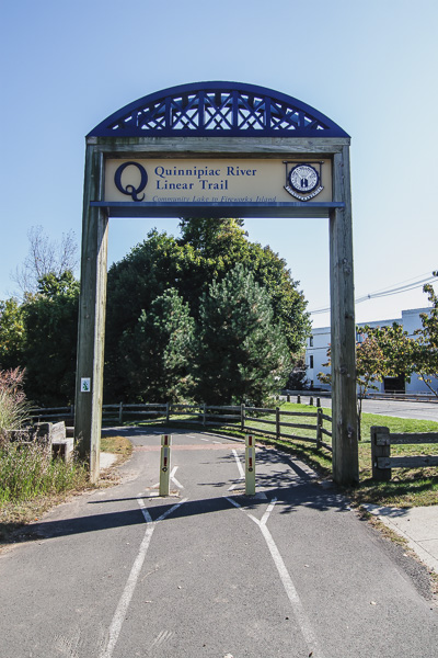
Despite its proximity to the Wilbur Cross Parkway, Wallingford’s Quinnipiac Linear Trail offers more than a mile of scenic serenity…and will soon have even more. A fully-funded trail extension, slated to begin by the spring of 2015, will add another 1.25 mile for pedestrian recreation and travel, as well as connect two areas of town separated by the parkway: Downtown Wallingford and Yalesville.

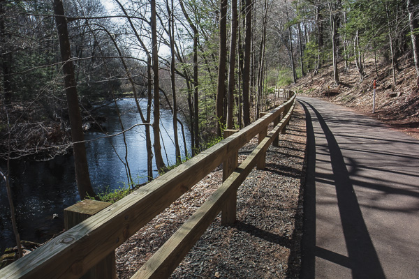
Wallingford’s current trail begins at Community Lake and runs north along the Quinnipiac River. Predominantly paved, the trail passes through cedar junipers and red maples, by one of the state’s largest red oaks, and ends after crossing under the parkway. Visitors can also visit a labyrinth nestled in manicured gardens or explore the unmarked trails of the Emerson Leonard Wildlife Area, which encompasses the land between the linear path and the river.

In September 2014, Wallingford’s trail committee received a $150,000 grant from the Connecticut Department of Energy and Environmental Protection – funding that will cover the final portion of the trail extension: a bridge from Fireworks Island to Wallingford’s Yalesville section. The Community Foundation for Greater New Haven is funding the informational sign for Fireworks Island.

Meriden

Quinnipiac River Gorge Trail

Trail access:
Red Bridge at Lions Club Park: Oregon Road and Route 70

Trail map:
http://www.scrcog.org/documents/trails/TrailMap-Meriden_QuinnipiacGorge.pdf

Since opening in 2007, Meriden’s 1.3-mile Quinnipiac River Gorge Trail has grown in popularity and use. The paved walkway begins at the Red Bridge near Hanover Pond and travels north to the Cheshire/Meriden border, providing nearly uninterrupted river views, access to stocked fishing, letterboxing and informational kiosks that provide histories for the Red Bridge, Oregon Dam, Toboggan Bridge, Boy Scout Island, and the Meriden-Cromwell Connecticut River railroad bed (circa 1890), on which the trail is built.

In 2013, Meriden added another .9 mile to its pedestrian trail system, with the construction of a paved path following Hanover Pond and Sodom Brook, which feeds the pond and river.

North Haven

Quinnipiac Blue Trail

Trail access:
Quinnipiac River State Park: Toelles Road (north) Banton Street (south)

Trail map:
http://www.scrcog.org/documents/trails/TrailMap-NorthHaven_ChapmanSinowa…

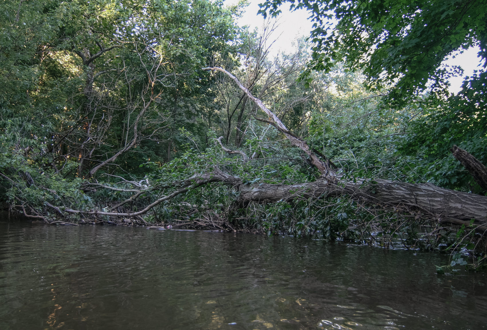
In North Haven the Quinnipiac River transforms from a brook-like river to a marshland maze, but to enjoy the river by foot, you’ll need hiking boots. Currently trail access is limited to two footpaths. In the north, a four-mile section, formerly part of the Quinnipiac Blue Trail, runs through Quinnipiac State Park on the west side of the river, but being in the floodplain, the path can be difficult to navigate due to mud and rapid growth of weeds and thistles. A new bridge built by the Boy Scouts in 2013 has helped cross Pine Brook, and Wallingford and North Haven trail committees are planning a hike to consider restoring the blue trail.

In the south, a footpath behind Target extends nearly a mile south on the Quinnipiac’s eastern bank, offering panoramic views and bird-watching opportunities, and, if the North Haven Trail Association’s efforts succeed, it will become the first official section of North Haven’s Quinnipiac Linear Trail.

The Trail Association originally planned to start with a deep woods and meadow trail in the northern section of town near Valley Service Rd, but when setbacks delayed progress, they shifted focus to the south where they are currently seeking agreements to connect separated segments.
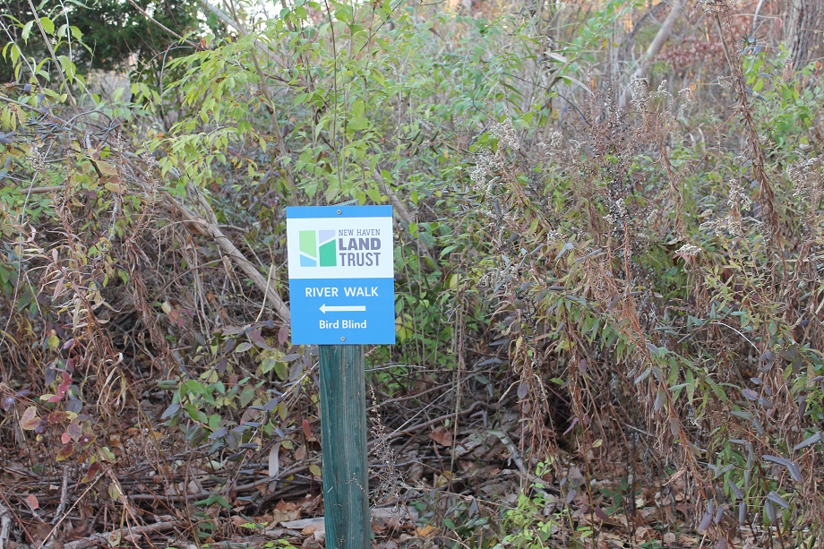
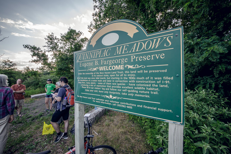
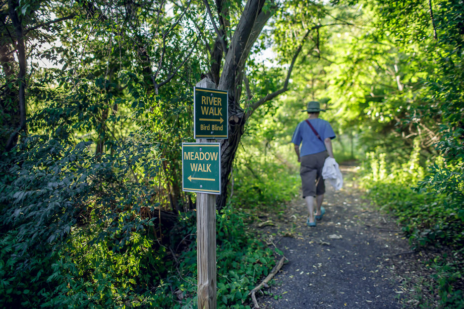
New Haven

 Quinnipiac Avenue and Front Street

In New Haven, the most popular pedestrian route along the river has a different form altogether. A 1.5 mile loop, traversed on sidewalks and park paths, circles the nationally and locally recognized Quinnipiac River historic district, providing panoramic views of the river and its historic assets. Without requiring any street crossings, the route passes over two historic bridges, through the Quinnipiac River Park and besides rows of brightly colored historically-preserved homes.