Making Strides: Recreation with a view
Making Strides: Recreation with a view
Nature and recreation go hand in hand, and when water is involved, the outdoors has an even greater allure. In New Haven County, the Quinnipiac River offers beautiful and convenient opportunities to soak in river scenery while taking a stroll, run, or bike ride.
Although access to much of the Quinnipiac’s 38 miles is difficult due to wetlands, dense woods and private development, more than five miles of pedestrian-friendly paved trails or roads flank the river, and plans have been proposed to create even more. Trail associations in the towns of Meriden, Wallingford and North Haven have a shared vision to develop a linear trail connecting the three towns, providing continuous pedestrian passage along the Quinnipiac for at least 15 miles.
Over the last decade, each town has made strides in making this vision a reality and in the process, created trails that can be enjoyed today.
Wallingford
Quinnipiac River Linear Trail
Trail access:
Lakeside Park: Hall Ave. and River Rd.
Trail map:
http://www.scrcog.org/documents/trails/Trail%20Map-Wallingford_Quinnipia…

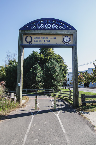
Despite its proximity to the Wilbur Cross Parkway, Wallingford’s Quinnipiac Linear Trail offers more than a mile of scenic serenity…and will soon have even more. A fully-funded trail extension, slated to begin by the spring of 2015, will add another 1.25 mile for pedestrian recreation and travel, as well as connect two areas of town separated by the parkway: Downtown Wallingford and Yalesville.
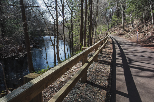
Wallingford’s current trail begins at Community Lake and runs north along the Quinnipiac River. Predominantly paved, the trail passes through cedar junipers and red maples, by one of the state’s largest red oaks, and ends after crossing under the parkway. Visitors can also visit a labyrinth nestled in manicured gardens or explore the unmarked trails of the Emerson Leonard Wildlife Area, which encompasses the land between the linear path and the river.
In September 2014, Wallingford’s trail committee received a $150,000 grant from the Connecticut Department of Energy and Environmental Protection – funding that will cover the final portion of the trail extension: a bridge from Fireworks Island to Wallingford’s Yalesville section. The Community Foundation for Greater New Haven is funding the informational sign for Fireworks Island.
Meriden
Quinnipiac River Gorge Trail
Trail access:
Red Bridge at Lions Club Park: Oregon Road and Route 70
Trail map:
http://www.scrcog.org/documents/trails/TrailMap-Meriden_QuinnipiacGorge.pdf

Since opening in 2007, Meriden’s 1.3-mile Quinnipiac River Gorge Trail has grown in popularity and use. The paved walkway begins at the Red Bridge near Hanover Pond and travels north to the Cheshire/Meriden border, providing nearly uninterrupted river views, access to stocked fishing, letterboxing and informational kiosks that provide histories for the Red Bridge, Oregon Dam, Toboggan Bridge, Boy Scout Island, and the Meriden-Cromwell Connecticut River railroad bed (circa 1890), on which the trail is built.
In 2013, Meriden added another .9 mile to its pedestrian trail system, with the construction of a paved path following Hanover Pond and Sodom Brook, which feeds the pond and river.
North Haven
Quinnipiac Blue Trail
Trail access:
Quinnipiac River State Park: Toelles Road (north) Banton Street (south)
Trail map:
http://www.scrcog.org/documents/trails/TrailMap-NorthHaven_ChapmanSinowa…

In North Haven the Quinnipiac River transforms from a brook-like river to a marshland maze, but to enjoy the river by foot, you’ll need hiking boots. Currently trail access is limited to two footpaths. In the north, a four-mile section, formerly part of the Quinnipiac Blue Trail, runs through Quinnipiac State Park on the west side of the river, but being in the floodplain, the path can be difficult to navigate due to mud and rapid growth of weeds and thistles. A new bridge built by the Boy Scouts in 2013 has helped cross Pine Brook, and Wallingford and North Haven trail committees are planning a hike to consider restoring the blue trail.
In the south, a footpath behind Target extends nearly a mile south on the Quinnipiac’s eastern bank, offering panoramic views and bird-watching opportunities, and, if the North Haven Trail Association’s efforts succeed, it will become the first official section of North Haven’s Quinnipiac Linear Trail.
The Trail Association originally planned to start with a deep woods and meadow trail in the northern section of town near Valley Service Rd, but when setbacks delayed progress, they shifted focus to the south where they are currently seeking agreements to connect separated segments.
New Haven
Quinnipiac Avenue and Front Street

In New Haven, the most popular pedestrian route along the river has a different form altogether. A 1.5 mile loop, traversed on sidewalks and park paths, circles the nationally and locally recognized Quinnipiac River historic district, providing panoramic views of the river and its historic assets. Without requiring any street crossings, the route passes over two historic bridges, through the Quinnipiac River Park and besides rows of brightly colored historically-preserved homes.
